
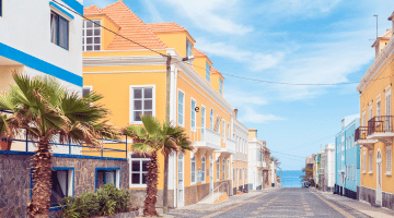
Cape Verde is a group of sub-tropical and volcanic islands in the Atlantic Ocean with a beautiful weather all year round. The former Portuguese colony is situated about 460 kilometers off the coast of Senegal (Africa). Fly only 2 more hours to the south from the Canaries and there is the Cape Verde archipelago. For example, it is only a 6 hours flight from Amsterdam or London. Each island is unique and different. Kilometers of white and sandy beaches, historical towns, unspoiled nature, whales and turtles, pleasant weather, great food and a Portuguese atmosphere. An ideal holiday destination for everyone!
In short
- Archipelago of 12 islands, 9 of which are inhabited
- Mix of beach destinations and lush hiking islands
- Warm, dry and sunny climate year-round
- Great for island hopping (short flights & ferries)
- Most popular: Sal, Boa Vista, São Vicente, Santiago
- Rich culture, music and traditions
- Best time to visit: November – July
Geographic location Cape Verde

Map location Cape Verde islands (Cabo Verde)
The Cape Verde islands are located a few hundred kilometers to the west coast of Africa in the North Atlantic Ocean. The islands are at the crossroads between Europe, Africa and America. The archipelago belongs together with the Canary Islands, Azores and Madeira to the Macaronesia region. The islands are over 4,000 square kilometers, of which the island of Santiago is the largest. The distance to Cape Verde is only 664 kilometers from Dakar (Senegal) and 2,887 kilometers from Faro (Portugal). The geographical coordinates are: 16.5388 ° N, 23.0418 ° W.
The islands
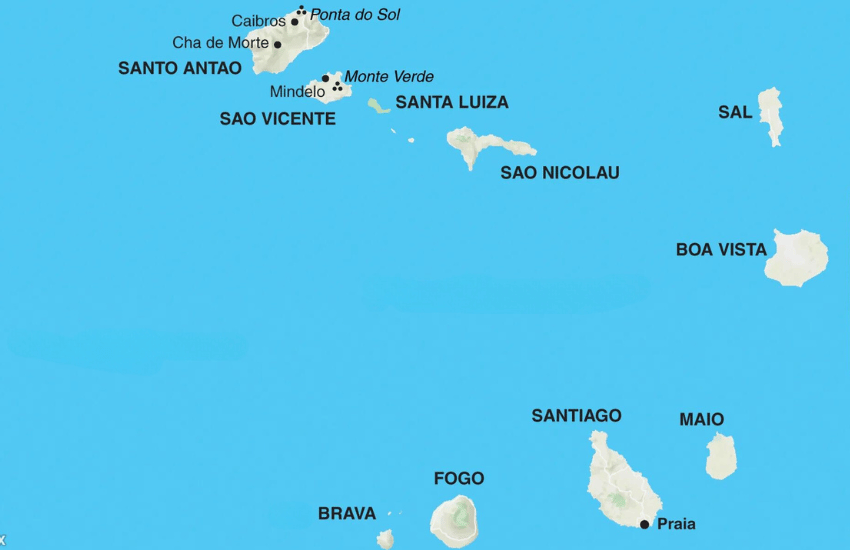
The various Cape Verde islands
The Cape Verde archipelago consists of 12 islands of which 9 are habited. Its location relative to the wind makes it possible to make a split between them. In the north the upper wind islands are located and in the south you will find the lower wind islands. The islands differ greatly from each other, which makes it so unique. Each island has its qualities and is suitable for certain activities such as surfing, hiking or enjoying beautiful beaches.
The upper wind islands include Sal, Boa Vista, São Nicolau, São Vicente, Santo Antão, Santa Luzia. Branco and Raso. These three last mentioned islands are uninhabited. On the upper wind islands of Santo Antão and São Nicolau you can admire spectacular mountain views and tropical valleys. São Vicente, however is known for its large harbor and the famous carnaval. The eastern part of the upper wind islands Sal and Boa Vista are more oriented towards tourists. These islands have wonderful white beaches and an azure sea.
In the south, the islands of Santiago, Fogo, Brava and Maio form the lower winds islands. Santiago is the largest island of Cape Verde. The capital Praia on Santiago has a rich history. Other southern islands are Fogo and Brava. The island of Fogo has an active volcano with a summit of nearly 3 kilometers. Brava is also known as the green oasis and is the smallest habited islands of the Cape Verde archipelago. The last island that belongs to the lower wind part is Maio. This islands also has beautiful white beaches.
How to get there?
You can get to Cape Verde by air and sea. There is a daily flight service, international and national flights. International airports are on the islands of Sal, Boa Vista, Santiago and São Vicente. From these islands you can take an domestic flight to one of the other islands. Check for airline tickets and all domestic airline connections the page with airline information.
Find your island
Each Cape Verde island has its own character. Answer 6 quick questions and discover which island suits you best. Find your island →